Meteorological Winter Begins
It's a new month and it's the beginning of meteorological winter. Astronomically, it doesn't commence until the solstice occurs at 6:12am on the 21st. This actually is the earliest arrival of winter since 1896! Can we say that it is going to be a long winter? Clearly, it is going to be more harsh than last winter! By the time it is all over, many might be saying that it was a very severe winter especially following the most open winter that most of us will ever experience. There is an element of the unknown going forward but I can give you some guarantees. For the month of December, the sunrise shifts from 6:54 at the beginning of the month to 7:13 at the end of the month. The sunset shifts from 4:12 at the start to 4:22 at the end. The earliest sunset happens on December 8 at 4:11pm. The average high temperature for Boston starts at 46 on 12/1 then ends at 38 on 12/31. The average low temperature starts at 33 on 12/1 then ends at 24 on 12/31. Boston's lowest temperature ever recorded in December was -17 degrees on the 29th in 1933! Its highest temperature ever recorded in December was 76 degrees on the 7th in 1998! December's Full Cold Moon occurs at 5:21am on the 28th. The highest scheduled astronomical tides actually occur during the new moon phase this month. The heights will exceed 12 feet during the late mornings of the 13th, 14th and 15th. The intense Geminid Meteor Shower will peak on the night of the 13th into the 14th with no moonlight interference. In case you missed the picturesque gathering of the Moon and Jupiter a few nights ago, there will be a strikingly close conjunction on Christmas Night.
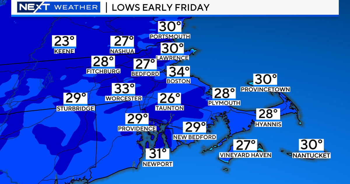
Weatherwise, we had a rather appropos day for the beginning of meteorological winter. Occasional snow showers this morning produced a widespread coating across the region ranging up to 0.5 to 1.5 inches except over Cape Cod. The temperatures held essentially constant through most of the day with upper 20s mainly west and north of the I-95 corridor from Providence to Boston. Milder air invading Cape Cod late in the day will ever so gradually nudge farther northwestward as the night progresses. Icing of some of the pavements plus patchy freezing mist may indeed produce slippery conditions from place to place especially over country roads, town streets and driveways and steps, etc. Be cautious! The National Weather Service has issued a Winter Weather Advisory for much of the night over inland zones. There could be some fog formation as well. As a warm frontal boundary sluggishly lifts across the area in the morning, there might be some more patchy mist and spotty showers. Eventually, some brightening should occur and much warmer weather will materialize with afternoon highs closer to 55 except in colder valley areas well north and west of Boston.
Looking ahead, a cold front will trigger a batch of showers hitting many but not all areas tomorrow evening. The showers should be offshore before dawn on Monday so a return of sunshine is anticipated with little cold advection behind that front. I am predicting another 55 or so on Monday. Tuesday will be the warmest day of the week as a southwesterly wind freshens ahead of the next approaching cold front. I'm shooting for 60 followed by another batch of showers later Tuesday night to near dawn on Wednesday. It should become partly sunny with afternoon snow showers confined to the hills and mountains up north. As a ridge of high pressure pushes into the region, it will be mainly sunny and breezy on Thursday with middle 40s for highs likely. After that, the next frontal boundary with a wave of low pressure will create wet conditions next Saturday. We'll have to watch all the arctic air in Canada. Eventually, we could be blasted with some of it about 10-14 days from now.
Joe Joyce delivers his latest WBZ AccuWeather Forecast in the morning and I shall return later in the day.
Enjoy the rest of the weekend.


