Nor'Easter In Forecast For Wednesday, Thursday
BOSTON (CBS) - It was only one week ago today, residents all along the Northeast were preparing for the arrival and landfall of Hurricane Sandy.
One week later, the power is returning, cleanup is progressing and life is slowly returning to normal for most outside of coastal New Jersey and Long Island.
Check: Current Conditions | Weather Maps | Interactive Radar
Unfortunately, the one thing that isn't returning to normal is our weather pattern.
The jet stream remains very active over the United States and is already beginning to dig another giant trough over the East Coast.
Two storms, one in western Canada today and one in the currently in the Midwest, will dive into the digging jet stream over the next few days, and like a roller coaster, bottom out near the Gulf of Mexico and get shot northward up the East Coast.
Because of the persistent block in the northern Atlantic they will have nowhere to go but here, combining to form another large and powerful coastal storm, hitting the same areas affected by Sandy.
Let me first stress that this will not be another Sandy. Winds will not be as strong, seas not as angry and rainfall not as heavy.
Gallery: Latest Forecast Maps
But, it will be a nor'easter nonetheless and come with its own set of concerns, especially for our coastline.
TIMELINE
Rain and wind arrive in tandem around dinner-time on Wednesday.
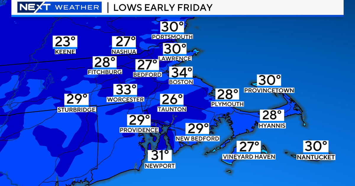
Conditions will rapidly deteriorate during Wednesday evening's commute. The peak of the storm will be overnight Wednesday into Thursday morning. The storm will not actually pass our latitude until Friday morning, but it will weaken significantly during the day Thursday and into Friday. The clouds, wind and rain won't completely be gone until Friday night.
COASTLINE
Once again, the coast will bear the brunt of the storm.
Thankfully, the tides are not astronomically high, so coastal flooding is expected to be minor, with some pockets moderate. High tides are generally around 5 p.m. Wednesday and 5 a.m. Thursday, and those will be the two most affected by this nor'easter. Seas will build to 15-to-20 feet just offshore and a storm surge up to a few feet is possible. One thing that is certain, significant beach erosion will occur.
One note - the hardest hit areas in Sandy were along the South Coast. With this storm the east coastal areas will be hardest hit due to a more northeasterly wind.
WINDS
Of greatest concern for the majority of our area, the wind.
Gusts along the coast are expected to be 40-to-50 mph but there is some potential for higher gusts Wednesday night, perhaps topping 60 mph in a few locations. Inland, winds will gust 20-to-40 mph frequently, a bit higher in more elevated locations, leading to some scattered power outages and tree damage. The winds will be out of the northeast (hence the term nor'easter). This is slightly different than Sandy when winds were more east or southeast.
RAIN
Rain will be heaviest Wednesday night into Thursday morning and in eastern Massachusetts.
Rain amounts will be 1-to-3 inches in general, not a great deal of inland flooding, and no concern for larger rivers.
SNOW
Yes that nasty "s" word, something we didn't need to discuss with Sandy.
The best chance of seeing some wet snow would be north and west of Boston in elevated areas such as the Worcester Hills, Monadnocks in SW New Hampshire and in the Berkshires. In these spots it would likely be a snow to rain scenario and just some dustings or an inch or so. Three-to-six inches is possible in the Green Mountains of Vermont and The Whites of New Hampshire.
You can follow Terry on Twitter at @TerryWBZ.


