Hurricane Sandy's Peak In Southern New England Comes This Afternoon
BOSTON (CBS) - Hurricane Sandy actually strengthened overnight and now is packing winds of 90 mph around its center.
This is a bit abnormal. Tropical systems do not typically strengthen as they move northward into cooler waters.
Gallery: Latest Sandy Forecast Maps
But Sandy is not your typical hurricane, as we have been saying all along, because this atmospheric setup is extremely unique.
As of 8 a.m. Monday, Sandy has begun to turn to the west-northwest, being drawn towards the East Coast by a strong, digging jet stream. This turn is crucial and how fast it happens has major ramifications on the eventual level of damage to southern New England.
Check: Tracking Maps | Interactive Radar | Current Conditions | Forecast Maps
There is reason for some optimism this morning.
The latest National Hurricane Center track along with many weather models are now taking the center of Sandy just a bit further south, a landfall near Atlantic City, New Jersey.
This is a small but critical change.
When you consider that the hurricane force winds now extend about 175 miles outward from Sandy's center and our south coast is some 250 miles from Atlantic City, you can see why we will likely be spared from the strongest, most destructive core of Sandy.
We now believe that the worst of this storm will be felt along the New Jersey Coast northward to New York City and Long Island.
If the current track holds, southern New England is likely to be spared from the brunt of this event, it will not be a catastrophic storm.
Gallery: Hurricane Sandy Photos
This does not mean we should let our guard down, this will still be a significant and powerful storm in Southern New England.
Here is what you can expect:
TIMELINE
The peak of Sandy for southern New England will come between noon and 8 p.m. Monday.
This is when we will experience the strongest winds both inland and along the coast. Sandy will make landfall around 8 p.m. and steadily weaken thereafter. The high tides near 9 p.m. along the South Coast and around midnight along the East Coast will be the last major concern with Sandy.
COASTAL ISSUES
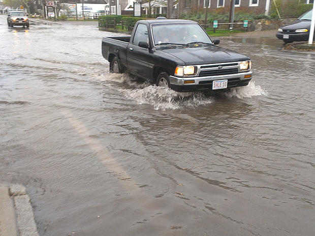
The coastline will be hit hardest by Sandy, especially during the times of high tide. Along the East Coast, high tides occur around midday and midnight Monday and we are forecasting a storm surge of about 2-to-4 feet.
This will mean moderate coastal flooding with some isolated pockets of major flooding. The South Coast will be most at risk for major, historic coastal flooding with the storm surge reaching 3-to-6 feet or higher.
WIND
We may be able to lower our peak wind forecast if Sandy continues to track slightly farther south. The strongest winds will certainly be along south coastal New England with gusts reaching 50-70 mph+ during the peak of the storm this afternoon and this evening.
Inland, we still are forecasting peak wind gusts from 25-50 mph with some isolated higher gusts, mainly in elevated areas. This will certainly be strong enough for numerous power outages and widespread tree damage.
RAINFALL
We are least concerned with the rain from Sandy. Only an inch or two of rain is likely through Tuesday morning, leading to some street and poor drainage flooding. Higher amounts may be found in upslope locations in the hills of Worcester County and western Massachusetts.
You can follow Terry on Twitter at @TerryWBZ.


