Get Ready for the Long Haul
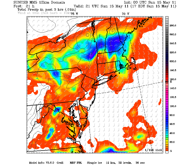
Heavy Rain pushing through the CT and Pioneer Valleys this morning is shifting east for the midday and afternoon hours. Strong Southerly winds aloft are advecting warm moist air into the northeast. A cold front from Canada is pushing south into New England today...bringing colder air behind it. This will create perfect overrunning and lift to Midday-afternoon showers and downpours to develop. SE winds will try to push temps into the lwr 60's south before the rain moves in...once the rain falls...it is 50's for all!
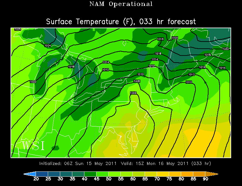
The cold front will be slowing as it crosses through the region tonight. Heavier rain will be shifting northward. Once the front is off the coast early tomorrow, winds will shift to the Northeast and make for a very chilly raw day Monday in the 40's and Lwr-mid 50's. The stalled front on the south coast will still be the focus for periodic showers...but the precip should be a tad lighter Monday with showers and drizzle.
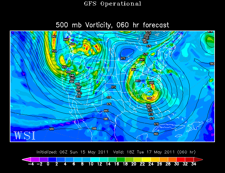
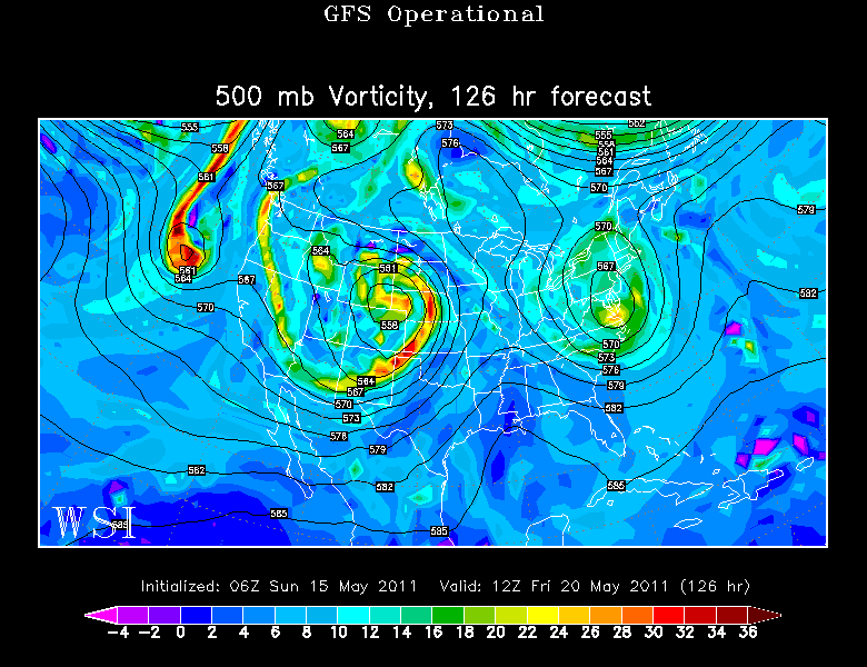
Meanwhile by Tuesday, the upper low will be wrapping up over the Carolinas with a deep negatively tilted trough which will be tapping tropical moisture and directing into New England with SSE winds aloft.
The air will be filled with water...so really we have a pattern where it could rain at any time. Timing the exact timing and placement of the downpours further out in time is futile. The pattern is recognized. The forecast is made. Now we will be shifting to Nowcasting mode as we track each downpour moving through.
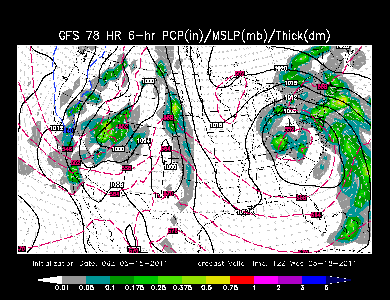
With the low stalled to the south of us, persistent SE winds will steer in bands of tropical moisture which will deliver periodic downpours which can deliver a quick half inch of rain in their passing. For the midweek, we will also have to watch the placement of the stalled front. Where it eventually settles is still a bit up in the air. If the stationary front remains along the south coast with NE winds...we remain cool damp and raw. SE winds may try to push this front to Boston which would enable some warmth in the 60's to penetrate into southern New England with a warmer more humid flow. It is a close call.
The upper low will be weakening by the end of the week, but it's eastward progression will still be slowed by the ridge out in the Atlantic in this blocking pattern. It is a slow breakdown. This upper low will impact our weather even into next weekend as it drifts south of us...and finally far en
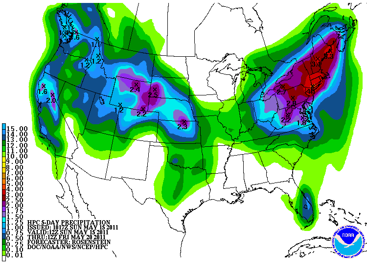
Several days of on and off rain will start to add up in the rain gauges. There is the potential for many areas to exceed 3" of rain by the end of the week. The fact that the rain will becoming in stages will help to prevent big flooding issues...but places who see persistent heavy rains may be in jeopardy of stream and river rises and basement flooding if stuck in slow moving downpours.
