Easy Breezy March...Above Normal Trend
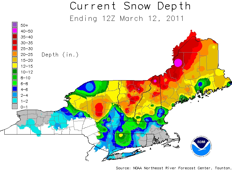
Definite light at the end of the tunnel. Besides a few rainstorms delivering couple inches of rain at a time...we could not have asked for a more ideal weather pattern to break down a historic snowpack which was in place February. There was a time this winter when around 200 structures roofs collapsed due to the weight of the heavy snow. It seemed like nature was giving us all we could handle. Then in turning off the switch of God showing mercy...the weather pattern flipped, the block lifted and it all has been pretty easy to take as we continue to tip toe march. A lot of snow has melted, but there is still plenty more in Northern New England, so a spring flood threat is still there even though is has mostly been avoided up to this point.
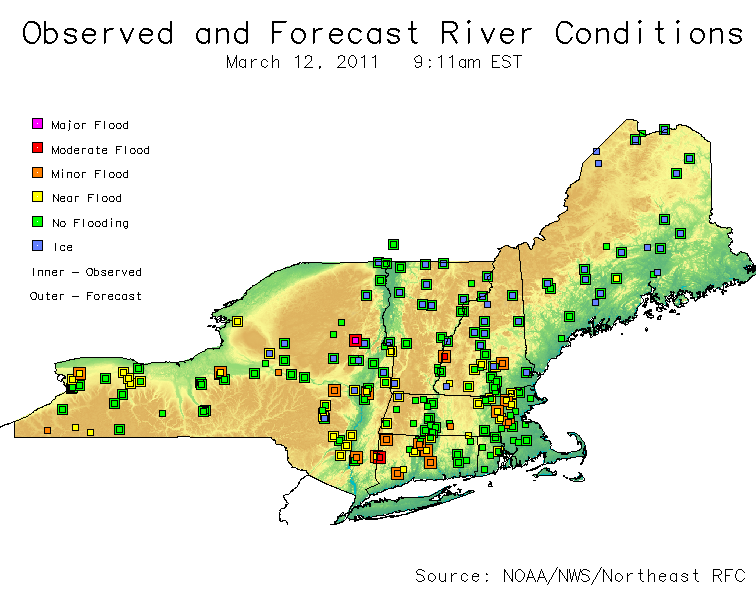
Recent rainfalls and the snowmelt have allowed for some minor to spotty moderate flooding. Most rivers are running high and near flood stage. Flood warnings are still up for a few rivers which are just running above flood stage...with just some localized lowland flooding occurring. With warming temperatures, ice jam flooding may become more of a threat as well in the near future across the north.
A milder Pacific flow has taken over much of the nation with temperatures building into the 60's and 70's south of the Mason-Dixon line. The jetsream remains just active enough that we will periodically see a few weak disturbance roll through, but very little cold air is involved in the pattern. There is pool of air in Canada...who is expected to have temperatures warmer than normal for at least the next week. Short waves that move across the country will not be as cold...which will mean mostly weak rain events with the chance of a little snow on the back side in the mountains. In fact the Climate prediction Center has the next 8-14 days averaging above normal for the eastern half of the US.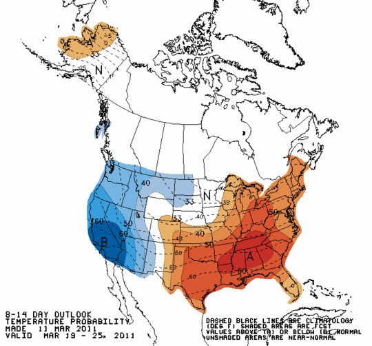
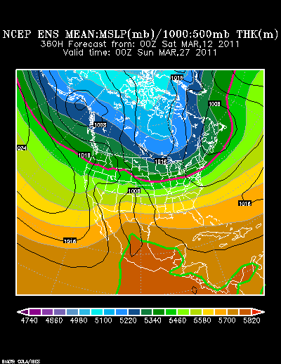
The Dry drought conditions are expected to persist in this La Nina Pattern. The dry weather will help the south to get warmer and warmer...and if lucky...we just may see a few chucks of that heading our way moving into the spring! The trend through the 27th of march will be a building ridge for the east coast behind each passing short wave...with a warming trend behind each frontal passage. Ridging this weekend, ridging midweek, ridging heading into next weekend...you get the idea...a persistant ridge in the eastern half of the US to allow the above normal temps to persist.
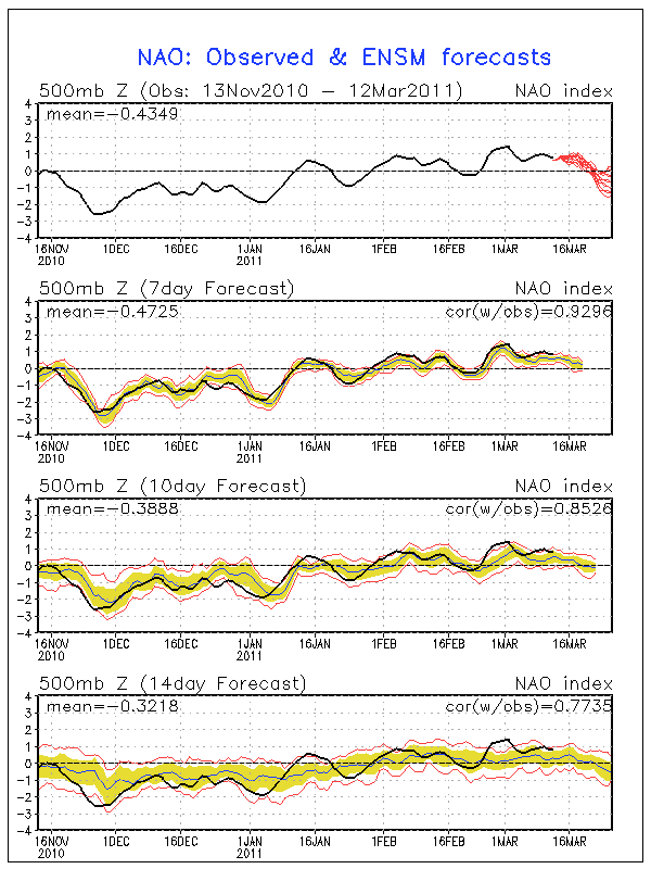
But what about after march 27th. I will admit, I thought the cold would have returned a little earlier before the month ended...but there may be a late season cool charge for early April? The NAO has been trending positive since February...and now looks like it is starting to trend towards the negative to close out March. As we know...a negative NAO can correlate l with an upper trough over eastern North America, as well as colder than normal weather and enhanced storminess.
So in summary, I expect much more of the same through the rest of March with mainly weak rain events followed by a warming trend through March 27th...what happens after that? I am expecting the return of the trough into the Northeast for some late season cool.
